Vital link, which will reduce distance between areas by 90 min, runs through mangroves land

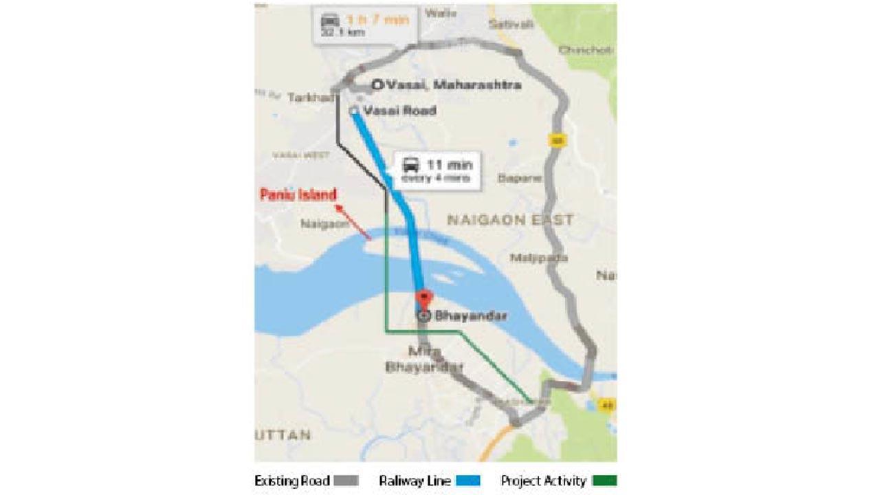
The railway line (blue) and stretch where bridge-related work will take place (green)
Work on the Bhayander-Vasai creek bridge that the Mumbai Metropolitan Region Development Authority (MMRDA) plans to construct parallel to the railway bridge might get delayed as the forest department’s go-ahead is awaited.
The 4.98-km-long and 30.6-metre-wide bridge will connect Bhayander West and Vasai West, reducing the travel time and distance between the areas by 90 minutes and 30 km. Vasai taluka's population of nearly 7.94 lakh is expected to benefit from the structure.
An MMRDA official said, “The forest department has yet not granted final permission to the MMRDA for the project. The Palghar collector has sent a compensatory afforestation proposal to the divisional commissioner, Konkan Bhavan, for approval.”
In April 2021, there was an important breakthrough with the MMRDA receiving a 9.86-hectare land parcel for the six-lane bridge from the government of India, the ministry of commerce and industry and the salt commissioner.
Also Read: Mumbai: Six days since Aarey mishap, cops yet to find the vehicle
The Bhayander-Vasai creek bridge alignment has been planned along the western side of an existing railway track where saltpan land is available and mangrove vegetation is very sparse and it belongs to the government.
The project alignment commences from Uttan Road near Netaji Subhash Chandra ground at Murdha Gaon, passes salt pan land, patches of waterlogged area and mangroves at the Bhayender side (2.16 km) and Panju island (0.77 km), Vasai creek (1.45 km) and Naigaon (0.59 km). It terminates at Coutino Road near Naigaon.
The mangroves area through which the bridge will pass is considered a protected forest and the MMRDA will have to take permission from the forest department to cut them. The proposed bridge involves the diversion of 3.44 ha of forest land.
The objective of the project is to improve the connectivity and transport and communication facilities between Vasai and Bhayander and nearby Panju village, which is currently not connected to any place via road. The village, in Vasai taluka, is situated on a natural island in Vasai creek. It has a population of around 1,400 as per the 2001 census.
The island’s locals have to use ferry services to get to Vasai from where they can access nearby areas, which is inconvenient and time-consuming. Hence, two ramps of approximately 600 m in length with an approximate width of 8.5 m (straight portion) and 12 m (curved portion) have been proposed to connect Panju island with the bridge directly. With the help of these, locals will gain direct access to Mumbai as well as Vasai, which could boost tourism on the island.
The project is important as it will be the direct connecting point between Mumbai and Vasai as well as Gujarat, as the existing NH-8 cannot accommodate the current traffic load and often sees severe traffic jams.
There is no road service which directly connects Vasai and Bhayander and both towns are connected via rail only. At present, Vasai locals have to travel via NH-8 to Kashimira and Mira-Bhayander via Chhatrapati Shivaji Maharaj Road, which is a journey of 39 km and it takes around 90 minutes. Once completed, the bridge will help motorists reach their destination in just 10 minutes, against the present travel time of over an hour.
6
No. of bridge lanes
 Subscribe today by clicking the link and stay updated with the latest news!" Click here!


