The urban sprawl disintegrates the compactness of the city, increasing the infrastructure cost and commuting time, stressing transport networks and destroying forests and wetlands

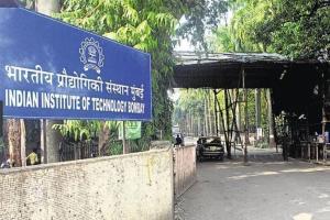
IIT Bombay/ File pic
A new study by a professor from the Indian Institute of Technology – Bombay (IIT-B) and a PhD researcher shows how digital interpretation of archived images and satellite data, could provide a base plan to predict growth directions in a metropolitan area. The study focuses on the Mumbai Metropolitan Region (MMR), wherein the researchers have studied growth patterns in the past four decades, presenting concerns over the declining balance between development and conservation of ecology.
ADVERTISEMENT
The study titled, 'Understanding How Cities Grow – using digital processing of archived satellite images to study the growth patterns in the Mumbai Metropolitan Region,' suggests the possibility of development of an algorithm to objectively predict future growth patterns in any metropolitan region, which can give a set of preconditions like capital investment or environmental damage. The study by Professor Shirish Gedam and Dr Priya Mendiratta, from the Centre of Studies in Resources Engineering (CSRE) at the IIT-B, was recently published in Applied Geography, the internationally acclaimed journal.
Landsat images used
The researchers studied the spread of built-up area densely covered by buildings, using archived Landsat images from 1972-2011. This data was then used to identify the direction and rate of growth of MMR, which consists of Greater Mumbai, Mumbai suburban districts, and parts of Thane and Raigad districts. The hypothesis of the study was that the decline in population density of the urban areas is at the expense of cultivated lands, forests and water bodies. The study found that during the four decades, the built-up area in the region had increased by 4.5 times, from 234 sq.km to 1,056 sq.km, whereas the population grew only three-fold. Thus the urban footprint was spreading more rapidly in comparison to the population. The urban sprawl disintegrates the compactness of the city, increasing the infrastructure cost and commuting time, stressing transport networks and destroying forests and wetlands.
Available natural resources
"While promoting growth in a particular direction, it is likely that decision-makers may overlook environmental conservation or utilisation of public money and/ or natural resources. However, when the growth directions over time are observed against the background of the geographical outlay of available natural resources, an algorithm can be deployed to objectively predict future growth directions for a given set of preconditions like capital investment or environmental damage. This is a typical mathematical problem with multiple variables, which, under a given set of opportunities and constraints, will have a unique solution," explained Dr Mendiratta.
Catch up on all the latest Crime, National, International and Hatke news here. Also download the new mid-day Android and iOS apps to get latest updates
 Subscribe today by clicking the link and stay updated with the latest news!" Click here!


