Airace is rooted in a commitment to accessibility and innovation, driven by our experiences and insights as an Indian company.

Swayambhu Mohanty, Co-Founder, Airace Technologies Private Limited
High-precision GNSS tools and user-friendly software are crucial for professionals to gather, visualize, and analyze location data for varied applications in surveying and agriculture. Swayambhu Mohanty, co-founder of Airace, explains how its solutions can help boost varied outcomes.
1. Can you explain wh at Airace does and how your products make people’s work easier in fields like surveying or agriculture?
At Airace, we specialize in providing cutting-edge geospatial solutions that enhance precision and efficiency across various industries, particularly in surveying and agriculture. Our primary focus is on integrating advanced GNSS (Global Navigation Satellite System) technology with user-friendly software, enabling professionals to capture, visualize, and analyze geographical data with remarkable accuracy.
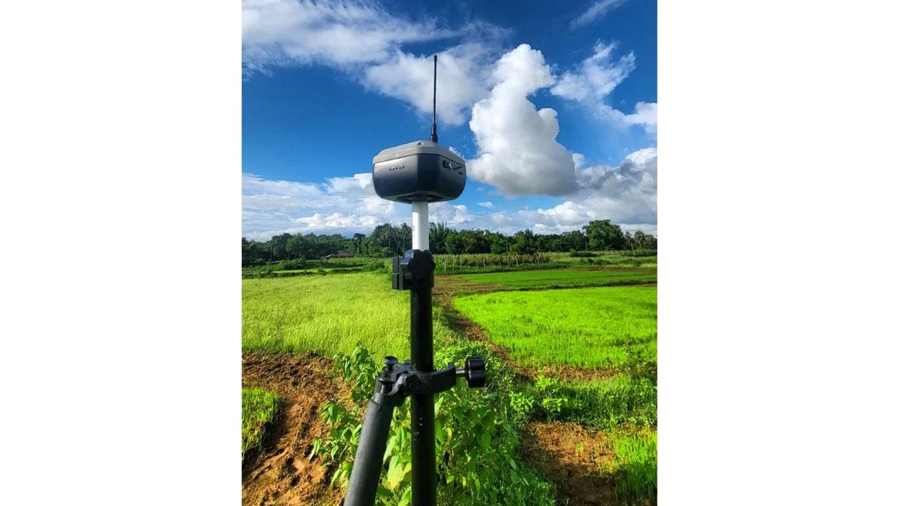
For instance, our flagship product, the Airace FX6i GNSS receiver, is designed to deliver millimeter-level accuracy, which is essential for tasks like land surveying, where even the slightest error can lead to significant consequences. The FX6i is lightweight and portable, making it easy for surveyors to transport and use in the field, even in challenging environments. When combined with our Airace One software, users can efficiently collect data, stake out points, and export results in various formats-all within an intuitive interface that simplifies the entire workflow.
In agriculture, our technology helps farmers optimize their practices by providing precise data for field mapping, crop monitoring, and yield prediction. With the ability to gather accurate geographical information, farmers can make more informed decisions about resource allocation, planting strategies, and harvesting schedules. By enabling professionals in these fields to work more effectively and efficiently, our products ultimately lead to better outcomes and increased productivity.
2. For someone who’s never used geospatial technology, how would you describe the Airace FX6i receiver and Airace One software? What makes them helpful for everyday users?
If you’ve never used geospatial technology before, think of the Airace FX6i receiver as a high-tech device that gives you incredibly precise location data-much more accurate than standard GPS. The FX6i is compact, lightweight, and easy to use, making it ideal for professionals who need reliable positioning information in their work. It captures data with millimeter-level accuracy, which means that you can trust the information it provides for critical tasks like surveying land or mapping out agricultural fields.
The Airace One software complements the FX6i receiver perfectly. It’s designed to be user-friendly, allowing you to easily set up the receiver, collect data, and even stake out points for your projects. The software guides you through the entire process, so you don’t need to be a technical expert to get started. You can visualize the data you collect, manage it efficiently, and export it in different formats that suit your needs. This ease of use makes the FX6i and Airace One suite accessible to a wide range of users, from experienced professionals to newcomers in the field.
In summary, both the Airace FX6i and Airace One software help everyday users by simplifying complex tasks, providing accurate data, and enabling them to make informed decisions based on reliable geographical information. Whether you’re a surveyor measuring land or a farmer planning your crop layout, our products make your work easier and more efficient.

Made in India, for the World
3. Why is making geospatial technology affordable and accessible important to you, and how has Airace worked to achieve that goal?
Making geospatial technology affordable and accessible is at the heart of our mission at Airace. We believe that everyone, regardless of their background or budget, should have the opportunity to utilize advanced tools that can enhance their work and drive better outcomes. The ability to access high-quality geospatial solutions can significantly impact various industries, from agriculture to construction, and we want to ensure that our technology benefits as many people as possible. To achieve this goal, we focus on several key strategies. First, we design our products with affordability in mind. For example, our Airace FX6i GNSS receiver is crafted to provide high precision without the high price tag often associated with such technology. By optimizing our manufacturing processes and utilizing locally sourced materials, we can keep costs down while maintaining quality.
Additionally, we prioritize user-friendly design in our software solutions, making it easier for users with varying levels of expertise to adopt our technology. The Airace One software, for instance, is designed to simplify the data collection and analysis process, so users don’t need extensive training or experience to get started.
We also engage with the community by providing educational resources and support, which helps demystify geospatial technology and empowers users to leverage our tools effectively. By hosting workshops and training sessions, we aim to build a knowledgeable user base that can confidently use our solutions in their work.
Ultimately, our commitment to affordability and accessibility is driven by our belief that empowering users with advanced geospatial technology can lead to greater innovation, improved productivity, and more informed decision-making across various sectors. We are dedicated to continuing this mission and making a positive impact in the geospatial landscape.
4. Could you share an example of how someone might use Airace’s technology in a real-world situation? For instance, how would a farmer or an engineer benefit from your products?
Let’s consider a farmer using our technology to optimize crop yields. Imagine a scenario where a farmer wants to maximize the efficiency of their land and ensure that they are planting their crops in the most suitable areas of their field. By utilizing the Airace FX6i GNSS receiver, the farmer can accurately map out their entire property, identifying soil types, elevation changes, and other critical factors that affect crop growth.
Using the Airace One software, the farmer can visualize this data in an easily interpretable format, allowing them to make informed decisions about where to plant different crops based on the specific characteristics of each section of their land. This targeted approach can lead to improved yields and more efficient use of resources like water and fertilizers.
Similarly, an engineer working on a construction project could benefit greatly from our products. For instance, while surveying a site for a new building, the engineer would use the Airace FX6i receiver to gather precise location data to ensure that the measurements align perfectly with the design plans. This accuracy is crucial in construction to avoid costly mistakes that could arise from incorrect measurements.
The engineer can then use the data collected in the Airace One software to create detailed site maps and share this information with their team, facilitating better communication and coordination among workers. By utilizing our technology, both farmers and engineers can achieve higher accuracy in their work, leading to more effective planning, resource management, and ultimately, better project outcomes.
 Airace
5. The Airace Onehub platform offers live tracking and project management. How does this make work easier for people managing big projects in the field?
The Airace Onehub platform revolutionizes the way project managers handle large field operations by providing real-time visibility and control over every aspect of their projects. Imagine a construction manager overseeing multiple teams on a large site; the ability to track live progress means they can see exactly where each team is working and how much work has been completed at any given moment.
With live tracking features, project managers can quickly identify any delays or bottlenecks and address them proactively, ensuring that the project stays on schedule. For example, if one team is falling behind due to unexpected weather conditions, the manager can reallocate resources or adjust timelines accordingly, minimizing downtime and maximizing productivity.
Additionally, the project management tools in Onehub facilitate better communication among team members. By providing a centralized platform where everyone can access up-to-date information, it reduces the chances of miscommunication and ensures that all team members are on the same page regarding project objectives and timelines.
Furthermore, Onehub allows for easy data collection and analysis, enabling managers to generate reports that can inform decision-making. This streamlined approach to project management not only enhances operational efficiency but also allows for more informed strategic planning, ultimately leading to successful project execution in the field.
6. You offer a free global service for RTK corrections. Why did you decide to make it free, and how does it help people who rely on precise location data?
Offering a free global service for RTK corrections through the Airace NTRIP Caster reflects our commitment to democratizing access to advanced geospatial technology. We recognize that many industries, particularly those in developing regions or small businesses, may struggle with the costs associated with obtaining high-precision positioning data. By providing this service at no cost, we aim to remove financial barriers that might prevent users from accessing the tools they need to perform their jobs effectively.
The impact of this free service is significant for professionals who rely on precise location data. For example, surveyors, farmers, and construction managers often require centimeter-level accuracy to ensure that their projects are executed correctly. With our RTK corrections available for free, they can access the high-quality data necessary to enhance their work without incurring additional expenses.
This service encourages greater adoption of RTK technology, leading to improved operational efficiency across various sectors. It enables users to achieve more accurate results, which can enhance productivity and reduce the risk of errors in critical applications such as land surveying and agricultural management.
Ultimately, our decision to provide free RTK corrections stems from our desire to foster a collaborative and innovative geospatial community. By making essential services available to everyone, we hope to empower users to leverage advanced technology, improve their practices, and contribute to the overall advancement of the industry.
7. What inspired you to start Airace, and how does being an Indian company shape the way you develop and deliver your products?
The inspiration to start Airace came from a strong desire to make advanced geospatial technology accessible to a broader audience, especially in a country like India, where there is immense potential for growth in various sectors reliant on geographical data. As someone deeply passionate about geomatics, I saw an opportunity to bridge the gap between cutting-edge technology and the needs of professionals who may not have had access to such tools due to high costs or complexity.
Being an Indian company significantly shapes our approach to product development and delivery. We are acutely aware of the unique challenges faced by users in diverse sectors across India, from agriculture to infrastructure development. This understanding allows us to tailor our products to meet the specific needs of our local market, ensuring that our solutions are not only effective but also practical and user-friendly.
Additionally, we take pride in leveraging the rich pool of talent available in India. Our team is composed of skilled professionals who are passionate about innovation and committed to driving advancements in geospatial technology. This local expertise allows us to create products that are relevant and valuable to our users while fostering a collaborative spirit within the industry.
Furthermore, as an Indian company, we are dedicated to contributing to the country's vision of self-reliance in technology. By developing solutions that are manufactured and supported locally, we aim to empower users and promote the growth of the geospatial ecosystem in India. Our mission aligns with the broader goals of enhancing technological capabilities within the country, and we are excited to be part of this transformation.
In summary, our inspiration to create Airace is rooted in a commitment to accessibility and innovation, driven by our experiences and insights as an Indian company. We believe that by providing high-quality geospatial solutions tailored to local needs, we can make a meaningful impact on various industries and help users achieve their goals more efficiently.
 Subscribe today by clicking the link and stay updated with the latest news!" Click here!


