Chief Minister Naveen Patnaik has rushed Odisha's Minister of State for Home, D S Mishra to Balasore to monitor the situation in the northern parts of the state.

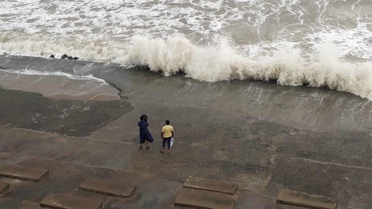
Sea turns rough, levels rise in West Bengal ahead of cyclone Yaas | Pic/Pallav Paliwal
Severe cyclonic storm ''Yaas'' is likely to make landfall near Dhamra Port in Odisha's Bhadrak district early on Wednesday morning, the India Meteorological Department (IMD) said.
ADVERTISEMENT
Dr Umashankar Das, a scientist at the Regional Meteorological Centre, Bhubaneswar said that the landfall will most likely be between Dhamra and Chandbali in the district.
IMD Director General Dr Mrutyunjay Mohapatra said that ''Yaas'' is likely to intensify into a Very Severe Cyclonic Storm (VSCS) by Tuesday evening and Chandbali is likely to witness the maximum damage caused by it.
At 0830 IST, SCS ‘Yaas’ about 280 km south-southeast of Paradip. To intensify further and cross north Odisha-West Bengal coasts between Paradip and Sagar Island close to north of Dhamra and south of Balasore, during noon of Wednesday, the 26th May as a Very Severe Cyclonic Storm. pic.twitter.com/U03UVjILj9
— India Meteorological Department (@Indiametdept) May 25, 2021
"Rain has already started and will continue. Wind speeds in Kendrapara and Jagatsinghpur districts will reach around 80 kmph by midnight," he said.
He said the impact will be severe for six hours before and after the landfall.
"Big trees and electric poles may get uprooted. Chandbali is likely to witness the maximum damage due to the cyclone," Mohapatra said.
Chief Minister Naveen Patnaik has rushed Odisha's Minister of State for Home, D S Mishra to Balasore to monitor the situation in the northern parts of the state.
Also Read: 'Flight services at Bhubaneswar, Kolkata, airports may be hit by Cyclone Yaas'
Official sources said that the evacuation process is underway in full swing in the coastal districts and over 50,000 people have been taken to safe shelters till noon.
The process will be completed by afternoon, much before ''Yaas'' nears the coast, they said.
The evacuation of people is being carried out keeping in view the IMD's warning of a tidal surge of around 2-4.5 metres during the landfall.
''Yaas'' is likely to move north-northwestwards and intensify further into a VSCS during the next 12 hours, the IMD said in its latest bulletin issued at 9.10 am on Tuesday.
The system has been moving north-northwestwards at a speed of 10 kmph during the past six hours. It lays centred around 320 km south-southeast of Paradip (Odisha), 430 km south-southeast of Balasore (Odisha) and 420 km south- southeast of Digha (West Bengal) at 5.30 am, it said.
Squally wind speeds reaching 50-60 kmph gusting to 70 kmph are prevailing over north Bay of Bengal and along and off Andhra Pradesh-Odisha-West Bengal-Bangladesh coasts, the weatherman said.
Wind speeds will increase to 155-165 kmph gusting to 185 kmph over northwest Bay of Bengal and along and off north Odisha and adjoining West Bengal coasts including Jagatsinghpur, Kendrapara, Bhadrak, Balasore districts of Odisha during landfall, it said.
In Odisha's Mayurbhanj district and West Bengal's Purba Medinipur and South 24 Parganas districts, wind speeds may increase to 100-120 kmph gusting to 145 kmph.
Wind speeds reaching 80-90 kmph gusting to 110 kmph will prevail over Odisha's Puri, Cuttack, Khurda and Jajpur districts and West Bengal's Jhargram, Paschim Medinipur and North 24 Parganas districts during the period.
The system is likely to cause heavy rain over large parts of West Bengal and Odisha on Tuesday and Wednesday.
''Yaas'' is also expected to cause a storm surge of 2-4 metres along the coastline of Purba Medinipur and 1-2 metres in South 24 Parganas.
The weatherman advised fishermen against venturing out into the sea till further information.
It warned of destruction to thatched houses, extensive damage to kutcha dwellings and some damage to pucca buildings in coastal and adjoining interior districts of West Bengal.
The MeT Department also warned of bending or uprooting of electric poles and disruption of railway services due to snapping of power lines and signalling systems.
The South Eastern Railways has announced the cancellation of several passenger special trains till Wednesday.
This story has been sourced from a third party syndicated feed, agencies. Mid-day accepts no responsibility or liability for its dependability, trustworthiness, reliability and data of the text. Mid-day management/mid-day.com reserves the sole right to alter, delete or remove (without notice) the content in its absolute discretion for any reason whatsoever
 Subscribe today by clicking the link and stay updated with the latest news!" Click here!


