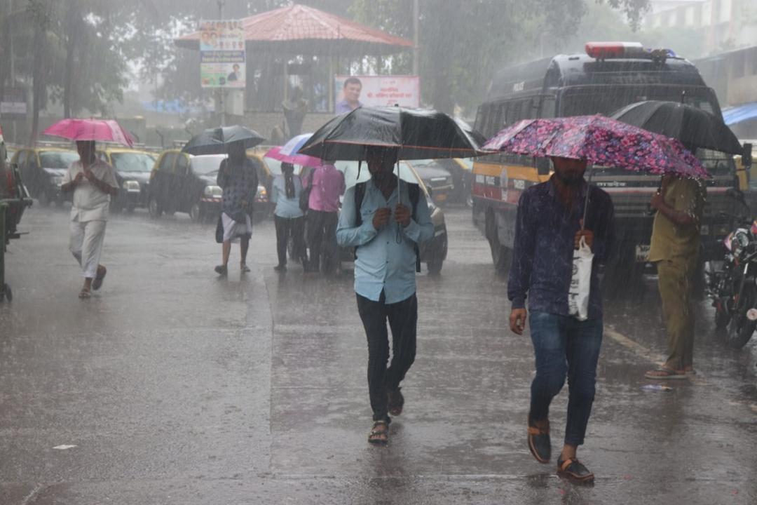
Mumbai weather update: For Saturday, the IMD has issued a 'green' alert for Mumbai, predicting light to moderate rainfall

Pic/Anurag Ahire
After a break from monsoon rain, the city woke up to moderate to heavy rains on Saturday. The India Meteorological Department (IMD) on Saturday predicted 'light to moderate spells of rain' in Mumbai and its suburbs.
ADVERTISEMENT
For Saturday, the IMD has issued a 'green' alert for Mumbai, predicting light to moderate rainfall.
"Light to moderate rainfall is likely in city and suburbs today," the Brihanmumbai Municipal Corporation (BMC) said on Saturday.
A high tide of about 4.84 metres is expected to hit Mumbai at 1.22 pm today, stated Brihanmumbai Municipal Corporation (BMC). The civic body also said that a low tide of about 0.35 metres is expected at 7.35 pm today.
The island city, eastern and western suburbs received an average rainfall of 3.08 mm, 14.28 mm and 2.93 mm respectively in 24 hours ending at 8 am, the civic body's data showed.
Meanwhile, after subdued rainfall resulted in India experiencing the driest August since 1901, the Southwest Monsoon is expected to revive over the weekend bringing rain to central and southern parts of the country, the India Meteorological Department (IMD) said on August 31.
Addressing a press conference virtually, India Meteorological Department Director General Mrutyunjay Mohapatra said September was likely to witness normal rainfall in the range of 91-109 per cent of the long period average of 167.9 mm.
However, Mohapatra said even if the rainfall in September was to remain on the higher side, the June-September seasonal rainfall average is expected to be below normal for the season.
After excess rainfall in July, the south-west monsoon played truant for most of August which witnessed 20 break days from August 6-17, August 21-22 and August 26-31 on account of El Nino conditions in the equatorial Pacific Ocean and unfavourable Indian Ocean Dipole conditions.
He said development of El Nino conditions in the equatorial Pacific Ocean was the most important factor behind the deficient rainfall activity in August. However, the Indian Ocean Dipole the difference in sea surface temperature of Arabian Sea and the Bay of Bengal has started turning positive, which could counter the El Nino impact, Mohapatra said.
He said the Madden Julian Oscillation -- the eastward moving pulse of cloud -- and the rainfall in the tropical region too was turning favourable and plays a role in the revival of monsoon.
With a 36 per cent deficit, India recorded the driest August since 1901. August receives 254.9 mm of rainfall, accounting for around 30 per cent of the precipitation during the monsoon season. The actual rainfall recorded in August was 162.7 mm.
India recorded a rainfall deficit of 25 per cent in August 2005, 24.6 per cent in 1965; 24.4 per cent in 1920; 24.1 per cent in 2009 and 24 per cent deficit in 1913, according to the IMD data.
Mohapatra said above-normal maximum temperatures were likely to prevail over most parts of the country, except over some areas in south peninsular India and some pockets of west-central India, where normal to below-normal maximum temperatures are likely.
He said above-normal minimum temperatures were likely over most parts of the country, except for some areas in extreme north India, where normal to below-normal minimum temperatures are likely.
(With inputs from PTI)
 Subscribe today by clicking the link and stay updated with the latest news!" Click here!


