Severe weather conditions affect Mumbai and surrounding regions; Raigad Fort shut until July 31; traffic hit in Sindhudurg and Ratnagiri

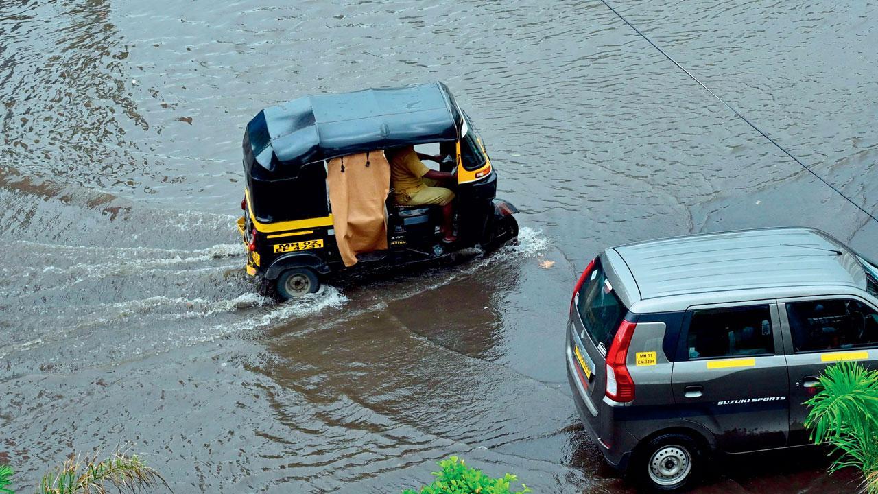
Vehicles wade through water logged road at Sion. Pic/Shadab Khan
Heavy rain has caused flooding in several parts of Maharashtra, especially around Mumbai, Raigad, Sindhudurg, Ratnagiri, Pune, and Satara. The Indian Meteorological Department (IMD) and private meteorologists expect the rain to ease from July 9 for a few days, but it will likely pick up again from July 11.
ADVERTISEMENT
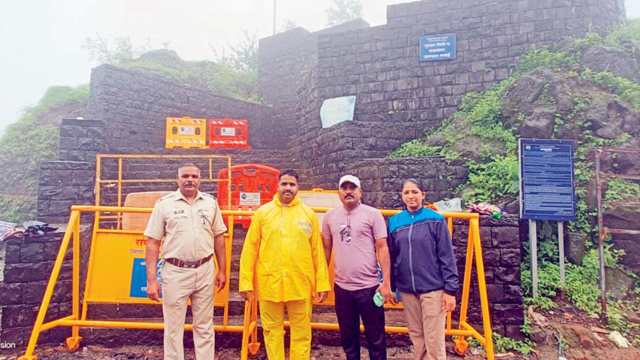
Heavy flooding at Raigad Fort near Mumbai left many tourists stranded. Authorities rescued the visitors and closed the fort on Monday. Despite social media claims of a cloudburst, officials confirmed there was none. The fort, about 170 km from Mumbai, will stay closed until July 31. Recent heavy rain in Raigad, part of Maharashtra’s Konkan region, led to the situation.

Raigad Fort closed for people. Pic/X
Due to flooding on the ‘Payri Marg’ (stepway) of the fort, tourists faced difficulties walking along that stretch, according to an official from the Mahad police station. Sindhudurg and Ratnagiri districts are facing flood-like conditions due to heavy rain, which has disrupted traffic.
In Buldhana district, heavy rain on Sunday evening was welcomed by farmers and residents. The rain continued overnight, with 16 areas, including two talukas, experiencing heavy rainfall. Many roads were closed, and a car was swept away near Khamgaon, though no one was inside. A nearby pan stall was also washed away.
“Apart from heavy rainfall, high wind speeds were recorded across Maharashtra, with Raigad experiencing winds of 65 kmph, Pune 33 kmph, and Satara 57 kmph in the 24 hours ending at 5.30 pm on Monday,” said an IMD official. “There will be rains, but the intensity is likely to reduce compared to the rainfall received from July 7 evening through July 8. A yellow alert (heavy rainfall in some areas) has been issued for Mumbai, Thane, Palghar, and Raigad, while an orange alert (heavy to very heavy rainfall) is in place for Sindhudurg, Ratnagiri, Pune, and Satara.”
Due to the incessant rains, NDRF teams have been deployed in Thane, Vasai, Mahad, Chiplun, Kolhapur, Sangli, Satara, Ghatkopar, Kurla, and Sindhudurg, in addition to regular teams stationed in Andheri and Nagpur, to respond to any flood-like situations.
Rajesh Kapadia of Vagaries of Weather, a popular weather blog, explained, “This rain was unpredictable and not forecasted by national or international models. The monsoon axis, typically positioned high in the north near the Himalayas, usually results in low rainfall in central and peninsular India. This condition normally lasts about four days until the axis moves south. However, on the evening of July 7, the trough unexpectedly shifted southward into central India, leading to a sudden increase in thunderstorms and widespread rains along the west coast, particularly in the Konkan region of Maharashtra.” Kapadia added, “The intensity of rains is likely to reduce by Tuesday, July 9, and is expected to increase again from July 11.”
Meanwhile, Skymet Weather, a private forecasting agency, stated, “The heavy showers are attributed to a cyclonic circulation at 5.4 km above mean sea level over Konkan and Goa, along with a trough stretching from south Gujarat to north Kerala. This weather system has unleashed heavy rain across the Konkan region, including Mumbai, Goa, and coastal Karnataka. Areas such as Goa (361 mm), Harnai (172 mm), and Ratnagiri (74 mm) have seen significant rainfall.” Skymet predicted, “The monsoon remains active over the west Coast, with moderate to heavy rain expected to continue over south Konkan, Goa, and coastal Karnataka for the next two to three days. Mumbai and its suburbs can anticipate moderate showers with occasional intense spells. Rain intensity is likely to pick up again from July 11.” According to the IMD, heavy rain ranges from 64.5 to 115.5 mm, very heavy rain from 115.6 to 204.4 mm, and extremely heavy rain exceeds 204.4 mm.
High rainfall in parts of Maharashtra
Mumbai 268
Tala 287
Nandgaon 279
Mhasala 273
Poynad 259
Murud 255
Chanera 246
Borli 203
Alibag 170
Shrivardhan 131
Avalegaon 378
Madura 343
Kasal 336
Dodamarg 305
Poip 293
Oras 276
Vetore 274
Banda & Padel 267
Baparde 264
Amboli 261
Talamba 257
Rameshwar 255
Shirshinge 248
Shirgaon 246
Mulde 245
Kadawal 243
Shiroda 241
Masure 237
Kudal 235
Pendur 225
Vengurla 214
Malvan 214
Devgad 198
Kankavli 193
Vaibhavwadi 185
Sawantwadi 183
Rainfall in mm
Data credit: IMD, Vagaries of Weather, State Agriculture Department
 Subscribe today by clicking the link and stay updated with the latest news!" Click here!


