Two natural disasters stirred a crowd sourcing initiative to create The Philippines Heritage Map. Follow it to discover the country in all its retro glory
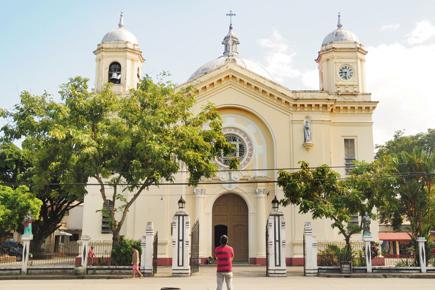
San Diego de Alcala Pro-Cathedral, Zamora corner. Rizal Street, Silay City.
ADVERTISEMENT
Adventure
Tour & Taste
Educational
Ancient & Historical
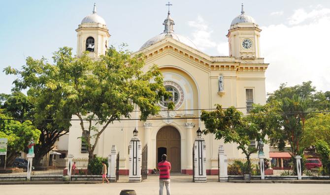
San Diego de Alcala Pro-Cathedral, Zamora corner. Rizal Street, Silay City. It was designed by an Italian architect named Lucio Bernasconi, and was completed in 1927. A wealthy but humble citizen from the town named Don Jose “Pepe” Ledesma y Rosario shouldered eighty per cent (80%) of the total cost of the construction, while the remaining twenty per cent (20%) came from the citizens of the town, which even included school children. Regarded as the nexus of the affluent and religious life of the sugar barons of the city, the church borrows Byzantine styles from similar churches in Italy.
The resemblance was unbelievable. A photograph of Sariaya Municipal Hall, an Art Deco building designed by architect Juan Arellano in 1931, in the Filipino city of Quezon, we thought for a moment was Mumbai's Regal Cinema. Joel Aldor, Project Director of The Philippines Heritage Map, agrees with the connect, recalling his visit around Fort and Colaba in 2011. Aldor is at the heart of The Philippines Heritage Map project, an online repository that went live in September. The platform pieced together by thousands of nameless self-motivated volunteers including heritage practitioners, cultural and tourism officers, architects, software developers and college students, showcases the Asian nation’s cultural and natural sites on the world heritage map.
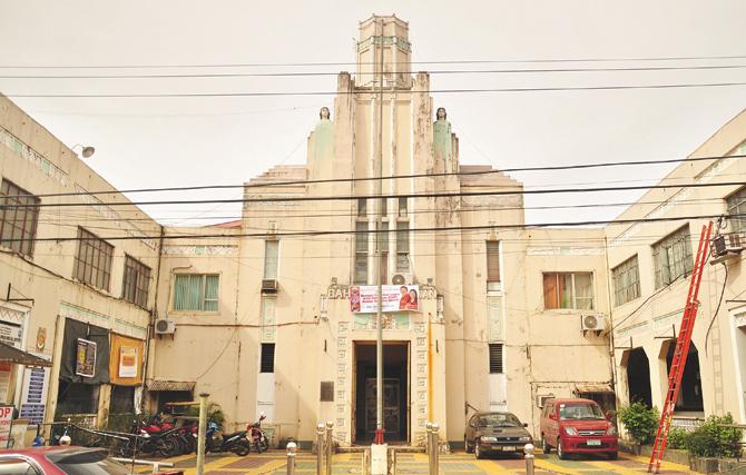
Sariaya Municipal Hall, Mabini Street, Sariaya, Quezon Province. Also, known as the ‘municipio’, the town hall was built in 1931 by renowned Filipino architect Juan Arellano. One of the best-preserved Art Deco buildings in the town, it exemplifies high Art Deco style in The Philippines’ civic structures that were built during the late American colonial era.
When nature strikes
Who would have imagined that a country ravaged by nature’s unpredictability will use adversity to build this successful project? “We envisioned the concept after The Philippines was struck by two disasters in 2013 — the 7.2 magnitude Bohol earthquake and Typhoon Haiyan. They occurred three weeks apart and created extensive, even obliterating damage, to our Spanish colonial structures including churches, heritage homes, cemeteries, watchtowers and forts,” says Manila-based Aldor over email. It was a challenge, he explains, to assess the extent of the damage to heritage structures, months after the dual disasters, largely due to a lack of available documentation. "That's when we realised it was time to pool in effort and invite expertise.”
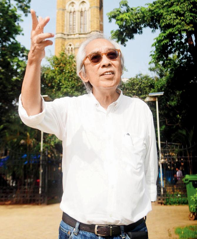
Augusto Villalon, heritage expert and town planner during a visit to Mumbai
Under the Arches
The project went underway but it was only in January 2015, when Arches — an international heritage documentation software system — came into the picture that the project took off. The global platform is known to offer background information for conservation or management planning across the world's heritage sites. Augusto Villalon, Filipino town planner and heritage expert, facilitated this introduction. He recommended the project to the Getty Conservation Institute, who responded by connecting the project with the Arches system team.
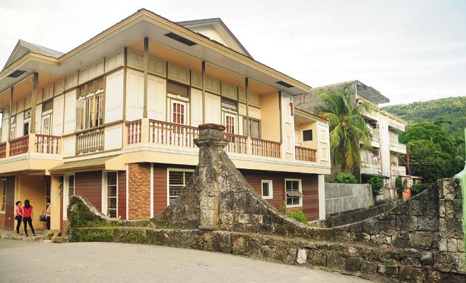
Puente de Romblon, Bagong Lipunan Street, Poblacion, Romblon. It is one of the three remaining Spanish bridges in the politico-military commandancia of Romblon island. Its most interesting facet is its undulating parapet walls that mimic the arches below, giving the parapet its graceful hyperbolic curves that terminates on a central pier. Despite little documented history about its construction, the design among all other Spanish bridges in the Philippines makes the structure culturally significant, earning its inscription an Important Cultural Property by the National Museum.
Charting the road map
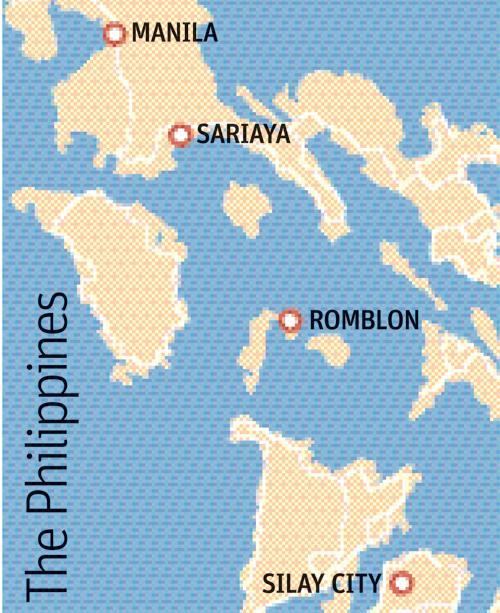
Seated in far-off Mumbai, we negotiate the digital heritage trail online that covers five locations across the Philippines, packed with interesting historic bytes and visuals. The homepage is inviting, the interface is clean, and the text is easy to plough through. As first-time visitor, we enjoyed the virtual tour and tripped over sepia-tinted Art Deco townships and resplendent Spanish-era bridges and cathedrals. Sated, we longed for more of the country’s diversity. Aldor reassures us, “What you see on the map is just the beginning. We plan to add tens of thousands of historic resources to the map in the next three years.”
While the initiative may sound like a godsend for tourism and conservation in a nation that has six recognised UNESCO World Heritage Sites, creating the map’s blueprint was a Herculean task. “Our first challenge was to deploy the Arches heritage inventory and management system successfully. We studied the system’s architecture for months to ensure that our diverse cultural heritage was presented meaningfully,” he says. The next step was to interpret and import the data from existing heritage inventories. It was vital that at the end of it, they had a living, breathing project.
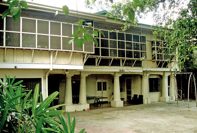
Lichauco Heritage House, 2315 Pedro Gil Street, Santa Ana, Manila. It is one of the only two houses in Metro Manila that is declared a National Heritage House. Built during the Spanish era on the banks of the Pasig River, it was acquired by Marcial Lichauco (prominent lawyer and dignitary during the presidency of Diosdado Macapagal) from the O’Brien Family, one of the few Americans who lived in Santa Ana. The wife of Marcial Lichauco, Jessie, currently lives in the house, eager to receive visitors and guest and tell stories of the glorious years of Santa Ana during the American period.
The youth will rise
With this ambitious a plan, technology’s role would seem inevitable at every step, especially to draw in the youth. Aldor's confidence reflects his vision: “We plan to create mobile applications to supplement inventory building and cultural mapping in the near future. The Philippine Heritage Maps undergoes continuous improvements to ensure that the heritage is presented such that people find it meaningful, and it helps them make an informed choice about managing their heritage sites.”
Villalon’s words from earlier find resonance. “It's the infectious energy of young heritage conservationists that infused life into this project.” It's this mindset that Aldor hopes will be the driving force behind conservation in The Philippines. “There's a growing movement among the youth for better protection and management of our historic sites. They understand the challenges that stakeholders, key government officials and civil society face in heritage conservation,” he shares, narrating how in the past, Filipino youth have relied on social media to stop demolitions, redevelopment projects that lack general consultation, and even unguided restoration projects. “It's they who will uphold Filipino pride in its cultural heritage.”

Project Director, Joel Aldor during a visit to Hampi in 2011
Log on to: www.philippineheritagemap.org/
 Subscribe today by clicking the link and stay updated with the latest news!" Click here!


